(This article started out as
part of a journal about the death of my cousin, Jim Byer and
the trip to Rolla, Missouri to handle his estate. It
was an amazing week and a half that included everything from
an exorcism to the fact that everything we needed was done
by about 5 people -- all somehow connected -- in a town
of over18,000.)
(Many of the pictures
are scanned images an of less quality)
|
| I
got the package from the lawyer, filled with court documents and
checks to sign. The court documents ask the court to close
out the estate of James I. Byer. The checks went to the news
paper, an accountant, the lawyer and myself. What was left
over Went to his two children. The house and property and
truck are sold. The guns and household property are sold.
That's about as final as you can get. By the end of the
month the bank account will be closed and it will be like dipping
your hand into a bucket of water and withdrawing it. The
estate will cease to exist. With it my last concrete
connection to the Ozarks. The people I grew up with, my
family - are gone. |
| As I
remember, Grandfather Kirkpatrick had two very good friends,
Mr. Gamble, owner of the hardware store and Mr. Noland, who was
appointed director of the State Poultry Experimental
Station. As most in that part of the country did in those
days, they hunted and fished together. My grandfather and his brothers, along with Mr. Noland and Mr. Gamble, had a fish camp on the Gasconade, not far below where the Whetstone joins it. It was located just over the hill north of the Rayborn general store. Eventually they built a cabin. Years later I ask my father about the cabin and he told me that it was long gone. I'm not sure who the men in the picture are, but I'd guess that the gentleman with the fish is a veteran of the Civil war. Nice fish. |
|
My mother's maiden name was Byer. Not Byers or Buyers, but Byer. A fairly unique name. They said they were "Pennsylvania Dutch." "Pennsylvania Dutch" came into vogue around the time of the first world war when being German wasn't something you bragged about. Grandfather Byer died at an early age, leaving two sons and four daughters. One of the sons joined the navy and ended up in a house overlooking Puget sound. Two of the daughters married and headed to California. The others stayed in Mountain Grove. |
The house is still there, almost
unchanged. Here's the Feese house today. The front
porch is different but the back porch is still the same.
The air conditioner's new too.
I see one of the walnut trees has been cut down. I'm sure that the wall phone has been replaced. The original phone was a crank phone. You yelled into the mouth piece while holding the ear piece to your ear. It was a party line. One ring was one party, two rings someone else, and so on. Not long after I was born and we moved in, the house got indoor plumbing. When you mention the Ozarks, most people think of hills. 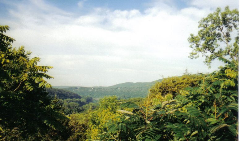 The Ozark "Mountains."
But in reality, most of the Ozarks are a
plateau that runs southwest of St. Louis through south
central Missouri, eastern Oklahoma and north eastern
Arkansas around Hot Springs.
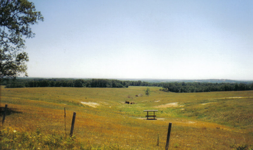 In this picture, taken north of
Cabool, Mo, you can almost see Arkansas, some 60 to 75
miles away.
The
"mountains"
are around the edge of the plateau, where the water
falls away to all points of the compass and carries the
soil and rocks with it. The land hasn't changed
much since I grew up. Nor have the creeks and
rivers that flow north, south, east and west from the
Ozark divide.
The water. The water's what shapes our lives. To paraphrase Melville, 'follow any path and 10 to one it'll lead you down to water.'
There were six of us, four adults and two younger anglers. I was about four or five at the time. The other young man was probably in his mid-teens and was wearing braces. (There was no Polio vaccine in those days.) I guess the other three men didn't want to be bothered by us kids so dad volunteered to take the two of us with him. The other three loaded up one of the old wooden jon boats and headed off down stream. It took dad a few minutes to get the other jon boat loaded and us settled in it. As I remember he didn't have a paddle, but was using a 1x6". As he pushed off from the bank the current grabbed the boat and sent us cross ways down the stream. Before he could gain control, the boat hit a bolder in the middle of the stream and flipped! Years later dad told me that the dread of having to tell his wife their only child had drowned spurred him into action. He grabbed me and placed me on the rock, then grabbed the young man with the braces and put him on the bank. After that he went after the boat and dumped the water out of it, then moved me to dry ground. Next came an attempt to recover our fishing gear. He again loaded the boat and we shoved off, much more carefully this time. I don't remember catching any fish but I must have. For years dad was always after me to fish, but for about 10 years he seemed to quit fishing himself. I never knew why. But he started fishing again a few years before he retired. He worked for the state highway department as a district supervisor. It carried him all over Wright and parts of Texas, Douglas and Howell counties. He'd always stop at bridges over good water to "check it out." My teen years and beyond weren't very productive times for dad to get me interested in fishing. I was more interested in girls! A stint in The army, earning a degree in business, getting married and a steady job seemed to change things. I began to look forward to trips home for a little fishing. The first summer Marge and I came home, dad and I took Marge fishing on Beaver creek. The water looks muddy and it probably was.
Once, I was home, at the same time as my uncle Earl Byer. Earl was 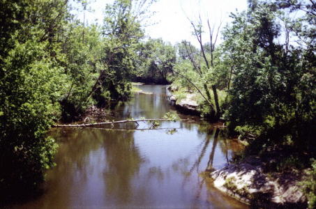 the
retired
Navy
Chief. He loved to fish as much as dad did and so
a fishing trip was arranged. There wasn't a lot of
time so, of course, the destination was Beaver
Creek. We put in under The bridge and started
fishing up stream, to the south. The picture
at the left was taken from the bridge, looking
south.. Beaver flows from over a riffle at the
left, into this hole. The low bluff can
produce some fair smallmouth bass. the
retired
Navy
Chief. He loved to fish as much as dad did and so
a fishing trip was arranged. There wasn't a lot of
time so, of course, the destination was Beaver
Creek. We put in under The bridge and started
fishing up stream, to the south. The picture
at the left was taken from the bridge, looking
south.. Beaver flows from over a riffle at the
left, into this hole. The low bluff can
produce some fair smallmouth bass. But that day it wasn't. That day nothing was. We decided to split up. I fished an old tree that was waterlogged and dad fished the riffle. Uncle Earl took the boat and headed back to the bluff. He smoked a pipe and must have thought that it would help him catch one of the smallmouth. But he discovered that he didn't have any matches so he got up to get some out of the tackle box. Now uncle Earl had spent a lot of time on board ship. But a jon boat isn't a USN ship. Uncle Earl forgot that. When the jon boat would roll to one side Uncle Earl would roll to the other. The boat would follow. Uncle Earl would correct. I think he and the boat rolled back and fourth about three times before they parted company. It was one of the most beautiful back dives I've ever seen. Undoubtedly a 10 by any standard. Uncle Earls arms outstretched, his back arched, head back. Almost a perfect entry into the water, pipe still in his mouth. Then he disappeared. The boat continued away from his point of entry and the waters calmed. I was alarmed. Was he hurt? Was he knocked unconscious? Suddenly uncle Early surface, like the white whale, water streaming from his head and shoulders. He swam after the boat and climbed back in. My father, who'd watched the same show from the riffle, said nothing for a second, then calmly, "Well, Earl, I think I had a bite."
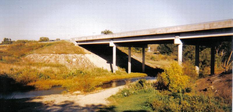 Here's where they put in, as it looked just a few years ago. Little Piney started over in Dent County and flows generally north west until it meets the Gasconade at Jerome just north of I-44. 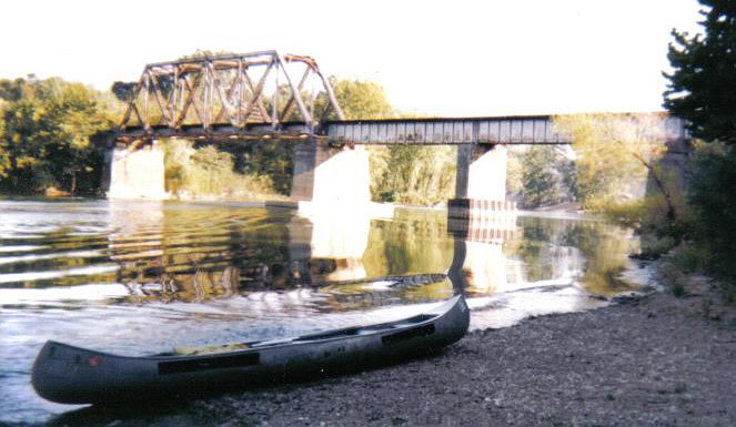 The Gasconade just after it's joined by Little Piney.
Maybe it's a good time to say something about Trout in Missouri. They didn't come there naturally. They were planted. There are about half a dozen places in Missouri where you can fish for hatchery trout. The hatchery truck stops under the US63 bridge. The area is now "artificial only." Montauk State Park is another place where you find trout. The park holds the head waters of the of the Current river. The Current was the first National Scenic River. It's a beautiful river that winds through the Ozarks down to the Arkansas boarder. There's good fishing on it, if you can miss the "canoe hatch." The river runs off to the east and south. I believe it empties into the Black, somewhere down in Arkansas. Another place to chase trout is Meramec State park. located south of St. James, just east of Rolla, it's the head water of the Meramec River that runs north east, toward St. Louis. Opening day at these parks is always a circus. If you've ever seen the pictures of fishermen, shoulder to shoulder, then you know what I'm talking about. I never liked either of the parks for fishing. So far we've followed the water that hit the north side of the house. Let's talk a little about water that hit the south side of the house. There were two major streams south of Mountain Grove. One fairly well known but the other less known today. The less known is Bryant Creek. Bryant Creek starts south of Mansfield and heads to the North Fork down around Tecumseh, just north of the Arkansas border. As it gets larger it holds some nice fish. It was one of the streams that was always discussed in the barber shop on Saturday morning if the home town football team had lost the night before. With one exception it was, and is, a well kept secret of the Ozarks. The exception is Rockbridge. Today Rockbridge is a tourist attraction. There's a privately owned trout farm and fishing opportunities. Fish all you want. It only costs $1 an inch. No catch and release! Dad and Ted Tanner father of Terry Tanner and one of dads co-workers, decided to fish Rockbridge. They took me along. barbeless hooks were strictly prohibited, but somehow Ted couldn't keep a fish on his line. They kept getting away. As for me, it cost dad $41 before he could get me stopped! I visited Rockbridge a few years ago and they still charge $1 an inch. This time I left my rod and reel at home. The other river is the North Fork of the White river, known locally simply as "the North Fork." It starts only a few miles from the old Feese place and becomes quite a stream before joining the White. Both Bryant Creek and the North Fork are fed by a host of springs and are capable of powering mills. Both of them did. The White and the North Fork are said to be the birth place of "float" trips -- putting in upstream and letting the current take you down stream to the take out point. All that came to an end when the Army Corps of Engineers built Bull Shoals Dam and North Fork Dam. Dad loved to watch the construction of the dams and many a weekend was spent driving down into Arkansas. I remember seeing The water start to rise behind the North Fork Dam, and the construction of Bull Shoals.
To get to this bridge I took state road 38 east from state road 95. I turned on to farm to market "E" at the Baptist Church Camp. The road took me atop a hill. At the top of this hill I could actually see both the Gasconade, on one side, and Whetstone Creek, far below on the other. It really fealt like I was sitting atop the world. I rememberd the day dad and I fished the Whetstone, below the road, in a leaky old plywood jon boat, that someone loaned dad. As I remember we caught a few largemouth that day. Eventually , if you live long enough, you get old. I never though of that when I was one of the youngest at the table on Thanksgiving. But as the years flew by, it became self evident. First Grandparents, then Uncles and Aunts were missing at the table. My mother's brother, "Buck", moved his Plumbing business to Rolla and his son, Bob took over the business. Buck contracted cancer and the last time Bob and Buck fished together was on Mill Creek, southwest of Rolla. Mill Creek feeds Little piney It starts at a spring and Bob and his wife stopped to on a bridge that spans the creek not far below that spring. The fishing was good, that morning, until Bob broke a tip. He went to his fathers house to borrow one of Buck's rods. When Buck heard about the good fishing, he couldn't stay home. At least part of Mill Creek is now controlled by TU. There's also a public park and picnic ground with access to the water. Bob wasn't generally a fly fisher. One year he took me to Canada, to fish for Muskie and Northern, but we didn't take a fly rod.
I have a head full of memories from those days. The land, the sky and the water. I remember fisheless days and days with some fish. I never remember catching a lot of fish but I remember catching a wide variety. I remember days when the sun was cool and the beer was cold. When leaves from the overhanging trees floated so thick you couldn't cast through them. 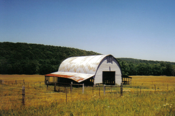 A barn in a field along
State Road 38, east of Hartville, Mo.
The Gasconade River runs along the edged of the Hillside in the background.
My cousin Bob died in Jan of
2002. Two years later His son Jim died
unexpectedly. I was Jim's only adult relative
that was close enough to the family to become
involved with the disposition of the
estate. And so I found myself walking through
Bob's house for the last time, turning over
the key to the realtor. There was no longer
any family reason to return to the Missouri
Ozarks.
I leave you with a puzzle. Bluemoon was a bar not far out the back of Ft. Leonardwood. It had no reason to exist except to sell booze to the soldies who didn't want anything else. On army payday the Sheriff would head over that way to try to head off a shooting or stabbing. Bluemoon is gone now. But something was left behind. I never could quite figure out what it was. 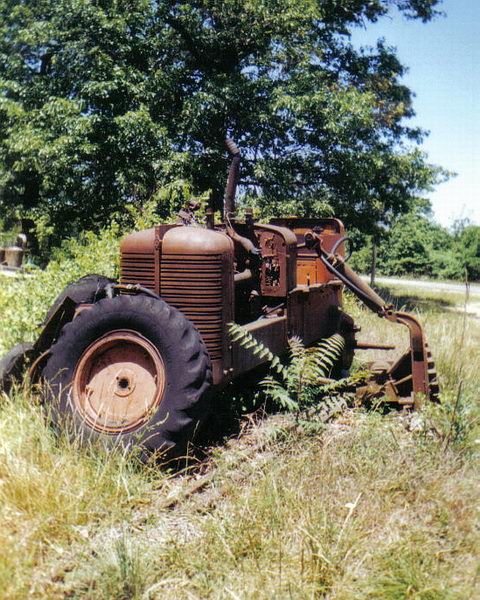 What is it??? |
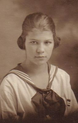
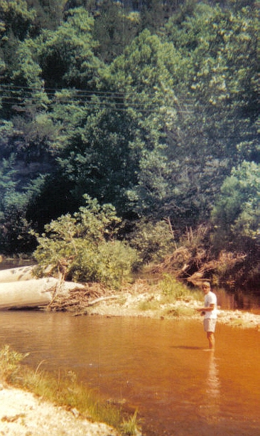 Next to
Beaver and the Gasconade, Little Piney has the
most memories for me. I still fish it each
time I return to Rolla, Missouri. My first
memory was of a picnic with my father, mother,
aunt Ethel, Uncle "Buck," Aunt Clara and
Grandmother Byer held on a gravel bar under the
US63 bridge. The old bridge, made of
guarders (looking much like the railroad bridge
in the picture above) is gone now, but the
supports are still there, though they've been
toppled on their sides. The new bridge
creates a small pool, which in turn dumps into a
riffle that turns into a run before entering
another long pool. I remember dad
fishing that run, at the picnic. The
picture at right was taken some years ago.
One of the old bridge supports can be seen at
the left of the picture. I'm standing at
the head of the riffle. There's a deep
hole around the support, that usually holds a
trout or two.
 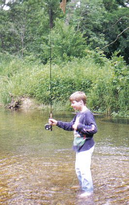 Over the years I've
become fairly good at fishing this stream.
The last time I was here, I took a couple of
nice sunfish and a little rock bass, even though
I only had an hour to fish the area. I've
taken several trout and both smallmouth and
largemouth bass.
  remember another time with my
wife Marge, cousin Bob, his wife Mary Jane,
and his grandson, Ben. We drove from
Rolla, down to Dawt mill. The dogwood
weren't in full bloom, yet, but we enjoyed the
ride and the talk. The mill sits on the
edge of a bluff, maybe 30 to 50 feet above the
water below. The mill race is directly
below the mill. The dam holds back a
good deal of the Northfork of the White
River. Looking down on it, I couldn't
help but wish I'd brought a rod, cold or not.